Why do the Torres del Paine towers have their distinctive shape?
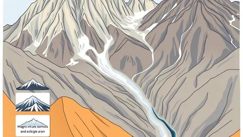
The towers combine resistant granitic rock with fractures that erosion could exploit. Magma cooled underground, uplift and erosion exposed the resulting rock, and glaciers removed surrounding material while enlarging weaknesses. Weathering continues to modify the steep faces.
The key distinction is between making the rock and shaping the landscape. Underground crystallization came first; the exposed towers are the result of much later erosion. They are not volcanic cones, and their pointed outlines do not mark eruption vents. Michel and colleagues’ research on incremental construction of the Paine intrusion provides the geological foundation for this distinction; see the Geological Society of America’s Geology journal. Glacial erosion processes are explained by the National Snow and Ice Data Center.
Think of the massif as rock exposed and carved over time, rather than mountains built in their present shape.
How did granite form beneath the Paine massif?
Granite formed when magma crystallized below the surface. Cooling underground allowed interlocking mineral crystals to grow, creating a coherent rock rather than a pile of erupted lava or ash.
A pluton is a body of igneous rock that solidified underground. A laccolith is an intrusion that spreads between surrounding rock layers and pushes the overlying layers upward. These terms describe emplacement, not the mountain’s present outline.
Michel and colleagues’ study describes incremental growth: separate additions of magma helped construct the intrusion. The age of one crystallized addition, the interval between additions and the duration of the whole construction process are different measurements. None directly dates the towers’ present silhouettes.
A useful relative timeline is:
- Before intrusion: sedimentary rocks occupied the area into which magma would enter.
- During construction: successive magma additions crystallized underground.
- During exposure: uplift and removal of overlying material brought intrusive rock toward the surface.
- During landscape carving: repeated glaciation and continuing weathering modified the exposed massif.
“Granite massif” is convenient shorthand, not a claim that every cliff has the same composition. The Paine intrusive complex includes contrasting igneous rocks alongside older country rock.
How did glaciers carve the towers and surrounding valleys?
Moving ice eroded existing rock through abrasion and quarrying. Abrasion occurs when debris carried beneath a glacier scrapes its bed. Quarrying removes blocks, particularly where fractures allow rock to separate. These processes are described in NSIDC’s glacier learning resources.
Ice moving along valleys can deepen and widen troughs. Erosion on adjacent slopes can leave narrower intervening ridges and steep rock walls. Fractures influence which blocks are removed, although no single process explains every face of a tower.
The broader landscape records repeated past glaciations, not simply the work of the glaciers visible today. Present ice occupies part of a landscape inherited from earlier conditions. Local glacial history requires regional field evidence; dates from other mountain ranges cannot be transferred to Paine.
Most importantly, ice sculpted the granite; it did not create it.
Why are the Torres pale while the Cuernos have dark tops?
The familiar contrast is between pale intrusive rock and darker remnants of surrounding sedimentary rock. The Torres are the slender towers associated with Base Torres. The Cuernos are the separate, horn-shaped peaks recognizable from the Lake Pehoé area.
Read the comparison this way:
- Torres: extensive pale granitic faces make the towers’ fractures and steep walls prominent.
- Cuernos: pale intrusive rock beneath darker upper rock makes the relationship between intrusion and country rock more visible.
- Dark upper material: remnants of older surrounding or overlying rock—not lava caps deposited on finished mountains.
Heat from an intrusion can alter adjacent country rock through contact metamorphism. Assigning a particular dark band to a mapped unit, however, requires geological evidence rather than a distant color judgment. Chile’s SERNAGEOMIN is the national geological mapping authority.
Shadow, surface moisture and weathering also change apparent color. A dark photograph is not a rock identification.
What geological features can visitors recognize in the landscape?
Visitors can recognize process clues, but a viewpoint rarely reveals a feature’s complete history. Use these observation pairs instead of trying to date the landscape by appearance.
- Rock fractures → potential weaknesses. Cracks help weathering and block removal shape individual faces. Their appearance alone does not establish when or why they formed.
- Steep walls → resistant rock and erosion. A cliff can reflect glacial excavation, structural weaknesses and later rockfall; it is not proof of one event.
- Broad valleys → possible glacial troughs. Their overall cross-section is more informative than an isolated slope, but geological mapping provides the stronger interpretation.
- Moraines → sediment accumulated by glaciers. Ridges of glacial debris can mark former ice margins, although not every loose ridge is a moraine and appearance does not establish age.
- Contrasting bands → changes in rock or surface conditions. Contacts may reveal intrusive and country-rock relationships, but color needs corroboration.
NSIDC provides the underlying glacier-process definitions. Observe from authorized visitor areas, leave rocks in place and do not approach unstable slopes to inspect a feature.
Where can visitors see the towers, horns and glacial landscape?
Base Torres, Lake Pehoé and the Grey sector offer different geological subjects. They are not interchangeable tower viewpoints.
- Base Torres — mountain walking route. The named Base Torres route focuses on the towers, steep basin walls and accumulated rock debris. Consult the current route description for walking distance, ascent and access conditions rather than borrowing figures from a different starting point.
- Lake Pehoé area — road-linked viewpoints and selected walks. The main interest is the broader massif and the Cuernos’ contrasting rock. Access and walking distance depend on the particular viewpoint; “Lake Pehoé” is not one standardized trail.
- Grey sector — walks or separately arranged boat excursions. The geological emphasis is glacier ice, sediment and the glacial basin. Shore access, mountain trails and boat itineraries have different starting points and arrangements.
Use CONAF for park-management information and the responsible transport provider for its own services. Visibility, trail access and transport must be checked, not assumed. Wind can interrupt sailings, and a booked excursion cannot guarantee an unobstructed view.
How can geology help you choose between the W trek and a day tour?
Choose by the landscapes you want to connect, rather than expecting every itinerary to show every feature. The W links contrasting sectors: towers toward the east, the French Valley’s enclosing walls in the central section, and glacier-related scenery toward Grey.
A day tour is more selective. A road-based itinerary can emphasize the massif’s overall shape and contrasting rocks; a Base Torres hike concentrates on the towers; a Grey excursion emphasizes ice and its surroundings. Check actual stops and inclusions rather than relying on the tour name.
Our guided W trek comparison explains programme differences, while the Base Torres day-hike guide focuses on that route. Booked-out accommodation, weather disruption and long travel days can affect the practical choice.
Compare the landscapes covered in our independent day-tour comparison. Relevant tour pages carry live GetYourGuide widgets for current offers. Torres del Paine Guide is an independent editorial site, not an operator; we may earn a commission from affiliate bookings.
Are glaciers and weathering still changing the Paine massif?
Yes: weathering, rockfall, moving water and glacier change continue to modify it. Water enters fractures, freezing can help widen cracks, and loosened material moves downslope. Streams transport sediment beyond the rock walls.
Glacier change requires a named glacier, a measurement period and a defined measurement. Changes in glacier length, area and thickness are not interchangeable. Regional averages should not be presented as measurements of Grey Glacier. Chilean scientific context is available through Glaciología.
Long-term landscape evolution does not predict conditions for an individual visit. Follow current park notices rather than interpreting a photograph as evidence that a slope, trail or sailing is safe or available.
What else should visitors know about the Paine massif’s geology?
Are the towers volcanoes?
No. Their granitic rock crystallized underground and was later exposed and eroded; the towers are not volcanic cones. Michel and colleagues’ intrusive-growth research is published in Geology.
How old is the granite?
Its crystallization age belongs to the underground construction of the intrusion, not the later carving of the towers. Michel and colleagues distinguish incremental construction in their Geology research; a single age should not be treated as the age of the visible landscape.
Did glaciers create the rock?
No. Glaciers eroded pre-existing rock through abrasion and quarrying. See NSIDC’s process explanations.
Why are the Cuernos different colors?
Pale intrusive rock contrasts with darker country-rock remnants above it, rather than a lava cap. Detailed unit identification belongs to geological mapping, including work held by SERNAGEOMIN.
Is a multiday trek necessary to appreciate the geology?
No. Selected viewpoints and day itineraries can reveal different parts of the story. Use the planning sections above to choose a setting, then check current access and transport; neither visibility nor availability is guaranteed.
Sources
Geological interpretation and visitor logistics require different sources. Geological research explains formation; current management notices govern a visit.
- Michel and colleagues, Geology: research on incremental growth of the Patagonian Torres del Paine laccolith; relevant to underground construction and the distinction between emplacement and landscape formation.
- SERNAGEOMIN: Chile’s geological mapping authority; relevant to identifying rock units and contacts, rather than identifying them from color alone.
- National Snow and Ice Data Center: educational explanations of glacier movement, erosion and depositional landforms.
- Glaciología: Chilean glacier-research context; individual local measurements require their own study and observation period.
- CONAF: official park-management information, visitor rules and access notices. Check the applicable notice before travel.